Do you have any plans to visit Nepal?

How Big is Mount Everest and Where is it’s Location?
Where is Mount Everest and How Big is Mount Everest?
The highest peak on Earth is a place that fascinates travelers and mountaineers all over the world. Situated among the mighty Himalayan range, Everest stands for the ultimate achievement in human discovery and perseverance.
Because of the importance of this landmark, we have prepared this article, in which we discuss the location of Mount Everest and explore its immense size, explaining the geographical, cultural, and natural significance of this legendary peak.
Where is Mount Everest?
Location of Mount Everest
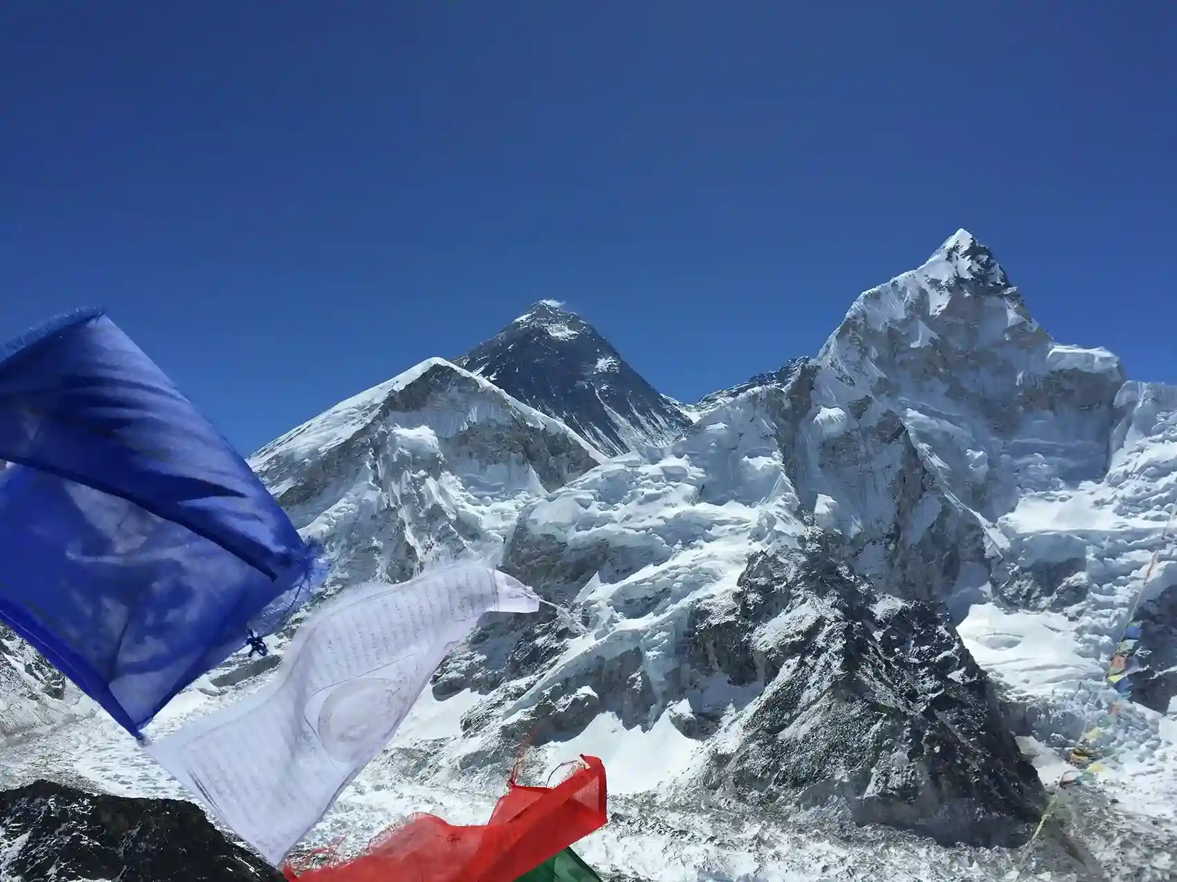
The Himalayan mountain range, which includes China, India, Nepal, Bhutan, and Pakistan, is home to Mount Everest. The actual location of Mount Everest is on the boundary separating China’s Tibet Autonomous Region from Nepal. Its exact coordinates are latitude 27°59′ North and longitude 86°55′ East. The mountain’s northern side is in Tibet, while the southern side is located in Nepal’s Solukhumbu district inside Sagarmatha National Park.
Another Name for Mount Everest
In Nepal, Mount Everest is known as Sagarmatha, meaning “Forehead in the Sky,” symbolizing the mountain’s towering stature and spiritual connection. The Tibetan name for Everest is Chomolungma, which translates to “Goddess Mother of the World.”
These regional names honor this magnificent peak in a way that is representative of the surrounding communities’ cultural admiration. Everest’s deities are pleased by a variety of ceremonies performed by the Sherpa people, who inhabit this mountainous terrain.
Accessibility and Popular Routes
There are two main access points for climbers attempting to summit Everest:
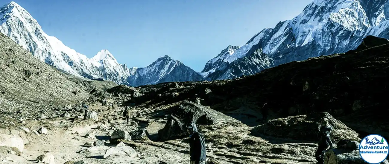
- Southern Route (Nepal): The most popular route starts in Nepal and begins in Kathmandu. From there, climbers fly to Lukla which is a small town in the Khumbu region. Then from Lukla, adventurers trek through villages like Namche Bazaar to reach Everest Base Camp.
- Northern Route (Tibet): Although less popular, the northern route is reachable from Tibet and it offers amazing views and its own unique set of difficulties. This route starts in Tibet’s capital city of Lhasa and continues via a lengthier and drier road.
How Big is Mount Everest?
Height of Mount Everest
Mount Everest’s official height is 8,848.86 meters (29,031.7 feet) above sea level. This measurement was determined by a 2020 survey conducted jointly by Nepal and China.
Over the years, several assessments and discussions have focused on Everest’s height. Because of tectonic activity in the area, including earthquakes and the shifting of the Indian and Eurasian tectonic plates, the height of the mountain can vary slightly in different years.
Comparison with Other Peaks
Although Everest is the highest peak as viewed from sea level, it is not the highest when viewed from the summit to the base. Mauna Kea in Hawaii holds this distinction, by rising more than 10,000 meters above its underwater base.
However, for mountaineers, Everest remains the ultimate objective because it is the highest point on Earth. By comparison, Everest is approximately 237 meters higher than K2 (the second-highest peak in the world) which is 8,611 meters (28,251 feet) tall.
How Everest Was Measured
The first successful measurement of Mount Everest was conducted in 1856 by British surveyors, who determined its height to be 8,840 meters. Since then, several expeditions have taken place to provide more accurate readings, using sophisticated technology such as GPS and radar.
The most recent measurement in 2020 used satellite data, which gave the now-accepted height of 8,848.86 meters. These measurements are crucial for understanding the tectonic movements that continue to shape the region.
The Growing Debate Over Height
Controversy around Everest’s height continues to persist. Scientists hypothesized that the mountain may have shifted or contracted as a result of tectonic pressures following an earthquake that struck Nepal in 2015.
In order to reconcile differences and determine whether Everest’s height had altered, remeasurements were carried out in 2020. Remarkably, reports of any appreciable shrinking were disproved by the discovery that the peak was marginally taller than previously noted.
The Mass and Volume of Mount Everest
While the height of Mount Everest often steals the spotlight, its mass and volume also contribute to its massive scale. The volume of the mountain is estimated to be around 3,879 cubic kilometers, making it one of the largest natural structures on Earth.
However, since Everest is part of the greater Himalayan range, it’s not an isolated peak but one among many massive mountains that have been formed over millions of years.
Geological Formation of Mount Everest
How is Mount Everest Formed?
The Indian and Eurasian tectonic plates collided more than 50 million years ago, creating Mount Everest and the entire Himalayan range. The land was forced higher as these two plates converged, resulting in the tall peaks that are visible today. Before the plates met, the sea of Tethys covered layers of limestone, shale, and marble, which formed the actual mountain peak of Everest. Here are the full details on how is Mount Everest formed-
1. Tectonic Plate Collision
The slow movement of Earth’s tectonic plates is responsible for the development of Mount Everest. India was a component of the vast southern hemisphere landmass known as Gondwanaland around 200 million years ago. The Indian tectonic plate started to move northward at a rate of roughly 5–10 cm annually over millions of years.
Eventually, this plate collided with the Eurasian plate, which resulted in the uplift of the Earth’s crust, forming the Himalayas. The immense force caused by the collision compressed layers of rock and pushed them upwards, creating Everest and other big peaks in the region.
2. Formation of the Himalayas
By a process known as subduction, the Indian plate continued to press beneath the Eurasian plate, creating the entire Himalayan mountain range, including Everest. The crust twisted and bent, pushing up big chunks of rock rather than one plate neatly sliding beneath the other.
Because of these extreme pressures, the Earth’s crust folded, forming the Himalayas, which includes Everest, which are known as fold mountains.
3. The Role of Sedimentary Rocks
It’s interesting to note that marine limestone makes up Mount Everest’s top, indicating that millions of years ago, the region that is now the Himalayas was beneath the Tethys Sea.
This old seafloor was driven upwards by the collision between the mainland of India and Asia, giving rise to the beautiful peaks that we see today. Much of Everest’s top regions are now composed of layers of sandstone, shale, and limestone that show the mountain’s prehistoric geological past.
4. Ongoing Growth of Everest
The Himalayas and Everest are still growing at a pace of around 4 millimeters per year because of the ongoing collision between the Indian and Eurasian plates.
The area is still experiencing geological activity, with tectonic movements and earthquakes periodically generating changes in the terrain. Because of this ongoing process, Everest’s height varies somewhat over a period of time too lengthy for people to perceive noticeable variations.
5. Earthquakes and Geological Activity
The region experiences regular earthquakes as a result of these plates colliding. For instance, the 2015 Nepal earthquake had a minor impact on Mount Everest’s height and structure. Scientists are keeping an eye on these tectonic shifts, which might have long-term implications for the entire Himalayan range, even if the mountain appears to be mostly unaffected.
Hence, the collision of the Indian and Eurasian plates is the result of the immense pressures of plate tectonics that gave rise to Mount Everest. This process has formed Everest into the world’s tallest peak over millions of years, and the area is still experiencing geological activity as the mountain slowly rises.
Climbing Mount Everest
How Long Does It Take To Climb Mount Everest?
It takes a lot of planning, practice, skills, and other resources to successfully climb Mount Everest, which is a great task. Approximately two months will go by before the Mount Everest adventure is over.
There are several ways that mountaineers can use to reach the Everest base camp. To begin the trip to Base Camp, climbers have two options: they can drive a bus from Kathmandu to Salleri or Jiri, or take a 35-minute flight to Lukla. Reaching base camp will take ten to fifteen days.
The real journey begins through the base camp. In order to adequately prepare and acclimate to the exposed higher altitude, climbers will spend weeks ascending and descending to various higher camps.
They will attempt their trek to Camp IV, which is situated close to the death zone at an elevation of 7950 meters, after being fit for the ascent. When they reach this altitude, the air’s oxygen content will decrease from 36% to 38%, requiring them to take on extra oxygen to sustain themselves.
It will take roughly five to six days after adequate acclimatization to reach the summit and return. Therefore, in the mountains, you have to battle to the death to survive.
Everest North Vs. South Route
There are two primary routes to reach the peak of Mount Everest which borders both China and Nepal. One starts from Tibet’s north ridge and the other from Nepal’s southeast ridge. However, by taking the more well-traveled South Route, Sir Edmund Hillary and Tenzing Norgay Sherpa became the first people to reach the summit in 1953.
Because of the distance to the summit, the weather, and the amount of time spent at high altitudes, the South Route is thought to be easier than the North Route. However, one of the riskiest parts of the ascent is crossing the infamous Khumbu Icefall on this route. Climbers then go up the steep and difficult Lhotse Face to the South Col (7,906 meters/25,938 ft), which serves as the last staging area for the summit attempt. Hence, because of the icefall and the steep ascent, the route is therefore regarded as less technical but physically difficult.
The North path does not pass through the Khumbu Icefall. Rather, because the route is open, climbers have to deal with the Second Step, a tricky rock wall near the summit, and the exposure to colder and windier weather.
The North Route is thought to be more demanding in terms of weather and technical difficulty, and it has a longer summit day. Although it is less busy than the South Route, many climbers find it less accessible since it involves more logistical planning, including obtaining permits from the Chinese government and passing through Tibet.
Elevation and Climatic Challenges
Because of its tremendous altitude, the location of Mount Everest poses serious problems for climbers. The death zone, which is over 8,000 meters (26,247 ft), is where the top is located. The oxygen concentration in this zone is only roughly one-third that of sea level, making it impossible for the human body to thrive without additional oxygen. Before making their last push to the summit, climbers may need to spend weeks acclimating to the altitude.
Temperature and Weather Conditions
During the winter, the temperature at the top of Everest can dip as low as -60°C (-76°F). In April and May, when climbing is most popular, the temperature can drop as low as -20°C (-4°F). Climbers are always at risk from the weather’s extreme unpredictability, which includes strong winds and unexpected storms. Because of these harsh conditions, climbing Everest is risky and it could raise the mountain’s death toll.
The Role of Mount Everest in the Global Ecosystem
Everest as a Water Source
An important part of the water cycle in the area is Mount Everest. The Ganges, Brahmaputra, and Indus rivers are among the principal rivers that receive water from the snow and glaciers that cover the mountain. Since millions of people in South Asia depend on these rivers for their water, Everest is an important part of the ecosystem in the area.
Environmental Concerns
There are many environmental difficulties despite the remote location of Mount Everest, especially due to human activity. Concerns regarding the mountain’s long-term effects on the environment have been raised by the rise in trash and waste in the area caused by the mountain’s appeal as a trekking and climbing destination.
Therefore, in order to preserve Everest’s delicate ecology and clean it up, organized clean-up missions and more stringent climbing regulations are being implemented.
Mount Everest in Popular Culture
Everest is now seen as a representation of human perseverance and achievement. It has served as an inspiration for many films, documentaries, and novels, motivating a new generation of explorers.
For many people, reaching the top of Everest is a lifetime goal and is seen as the ultimate test of perseverance and resolve.


